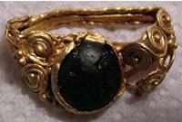
Saxon
and Roman gold
Archaeology
South-East
CONTENTS
1.0 INTRODUCTION
2.0 SITE TOPOGRAPHY AND GEOLOGY
3.0 ARCHAEOLOGICAL BACKGROUND
4.0 CARTOGRAPHIC EVIDENCE
5.0 AERIAL PHOTOGRAPHS
6.0 WALKOVER SURVEY
7.0 EXISTING IMPACTS ON ARCHAEOLOGICAL POTENTIAL
8.0 SUMMARY OF POTENTIAL AND CONCLUSION
9.0 PRELIMINARY RECOMMENDATIONS FOR FUTURE WORK
10.0 ACKNOWLEDGMENTS
SOURCES CONSULTED
Appendix 1: Summary Table of SMR Entries
Appendix 2: Tithe Apportionment (1839)
Appendix 3: Tithe Apportionment (1844)
LIST
OF ILLUSTRATIONS
Fig. 1 Site Location and SMR data
Fig. 2 1777, Chapman & Andre
Fig. 3 1796-1800, Ordnance Survey Draft Drawings, 1-inch Old Series
Fig. 4 1839/1844, Tithe Maps (composite)
Fig. 5 1875, Ordnance Survey 6-inch, 1st ed., Sheet XXVIII.
Fig. 6 Detailed Cropmark Plot of Site
Fig. 7 Cropmark Plot showing wider landscape PLATES
Plate 1. Aerial Photograph (22/06/1980) – view of western field
looking NW
Plate 2. Aerial Photograph (03/07/1986) – view of site looking
NW
Plate 3 Aerial Photograph (22/06/1976) – view of site looking
SE
Plate 4 Aerial Photograph (17/07/1980) – view of cropmarks south
looking NW
Archaeology
South-East
East of Essex
1.0
INTRODUCTION
1.1 Archaeology South-East (a division of the University College London
Field Archaeology Unit) has been commissioned by to carry out an archaeological
appraisal, consisting of a desk based assessment and preliminary walkover
survey, of farmland to the East of Colchester, Essex (Fig. 1).
1.2 This report follows the recommendations set out by the Institute
of Field Archaeologists in Standards and Guidance for Archaeological
Desk-Based Assessments and utilises existing information in order
to establish as far as possible the archaeological potential of the
site.
1.3 This report has been prepared using a standard set of sources
comprising archaeological, photographic and cartographic data, including
appropriate published works. During initial discussions between the
author and the client, and during a subsequent site visit, attention
was drawn to a vast array of artefactual material that has been recovered
through the use of metal-detectors over a number of years by the client
and his associates. The results of this work are far too numerous
to deal with in any detail in a report of this scope, and are, in
any case, catalogued in impressive detail on two websites, one run
by the client (www.colchestertreasurehunting.co.uk) and the other
relating to the Celtic Coin Index, maintained by Philip de Jersey
of the Institute of Archaeology, University of Oxford (www.writer2001.com/cciwriter2001/).
It is the intention of this report,
therefore, to deal with these finds in a summary form and to concentrate
on those aspects of the development of the site that are less familiar,
particularly the important cropmark evidence. It is to be hoped that
the coin evidence will be the subject of a detailed study in the future.
1.4 The site location, and study area is shown on Fig. 1. Centred
on National Grid
Reference XXXXX , the site lies approximately XXXX metres to the East
if XXXXXXXXThe site occupies the south-western half of a broadly square
plot of land occupied by two arable fields, and measuring approximately
23 hectares. The site is enclosed by a combination of hedgerows of
18th-19th century date and modern fence lines, and the present land-use
is arable, which at the time of the site visit had been harvested
1.5 It should be noted that this form of non-intrusive appraisal cannot
be seen to be a definitive statement on the presence or absence of
archaeological remains within any area but rather as an indicator
of the area’s potential based on existing information. Further
non-intrusive and intrusive investigations such as geophysical surveys
and machine-excavated trial trenching are usually needed to conclusively
define the presence/absence, character and quality of any archaeological
remains in a given area.
1.6 In drawing up this desk based assessment, cartographic and documentary
sources held by the Essex County Records Office at both Chelmsford
and Colchester have been consulted. Archaeological data was obtained
from the Sites and Monuments Record held by Essex County Council.
Relevant sources held withinChelmsford and Colchester reference libraries
and the Archaeology South-Eastlibrary were utilised, and appropriate
Internet databases interrogated. These included: The Defence of Britain
Project, The English Heritage NMR Excavation
Index and National Inventory, and the Magic website, which holds government
digital data of designated area sites in GIS map form. Relevant aerial
photographs from the National Monuments Record, Swindon, have also
been also obtained.
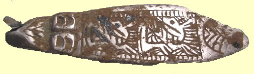
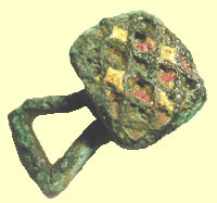
Anglo
Saxon strap end
2.0
SITE TOPOGRAPHY AND GEOLOGY
2.1 The area has no specific topographical features other than being
generally flat and level, with a gentle slope down to the stream valley
along the southern and south-western margin of the site.
2.2 The natural geology of the site comprises sands and gravels of
the Kesgrove Formation, with London Clay along the southern margin.
3.0
ARCHAEOLOGICAL BACKGROUND AND POTENTIAL
3.1 Introduction
3.1.1 The Sites and Monuments Record maintained by Essex County Council
(ECC),and held at County Hall, Chelmsford was consulted. Details were
taken of all archaeological sites and listed buildings within a 1-kilometre
radius of the site (hereafter referred to as the Study Area). Sites
with generalised grid references within the 1-kilometre radius were
also included. The identified sites are tabulated in Appendix 1 and
shown plotted on Fig. 1 (site numbers within brackets refer to cropmarks).
3.2 Scheduled Ancient Monuments and Designated Sites
3.2.1 These comprise cultural heritage sites of a higher degree of
status and significance, some of which enjoy a certain degree of legal
protection from development and include Scheduled Ancient Monuments
(SAMs), Listed
Buildings, Historic Parks and Gardens, Ancient Woodland and Conservation
Areas. These designations and others such as Archaeologically Sensitive
Areas and Areas of High Archaeological Potential are typically detailed
in BoroughCouncil Local Plans and County Council Plans with appropriate
planning policies
pertaining to each category.
3.2.2 No designated sites lie within the study area, although two
Listed Buildings are present in the vicinity
3.3 Archaeological Periods Represented
3.3.1 The timescale of the archaeological periods referred to in this
report is shown below. The periods are given their usual titles. It
should be noted that for most cultural purposes the boundaries between
them are not sharply distinguished, even where definite dates based
on historical events are used. Sub-divisions within periods are not
considered separately.

Prehistoric: Palaeolithic (c. 500,000 BC - c. 10,000 BC)
Prehistoric: Mesolithic (c. 10,000 BC - c.5,000 BC)
Prehistoric: Neolithic (c. 5,000 BC - c.2,300 BC)
Prehistoric: Bronze Age (c. 2,300 BC - c. 600 BC)
Prehistoric: Iron Age (c. 600 BC - AD 43)
Romano-British (AD 43 - c. AD 410)
Anglo-Saxon (c. AD 410 - AD 1066)
Medieval (AD 1066 - AD 1485)
Post-medieval (AD 1486 to date)
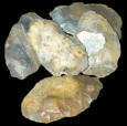
3.4 Prehistoric: Palaeolithic
3.4.1 Palaeolithic material has been found at a number of sites in
Essex and the neighbouring part of Suffolk, with significant quantities
of material derived from the river valleys around both Colchester
and Ipswich. As with elsewhere in Britain the vast majority of these
find spots are of artefacts, typically hand axes, which have almost
certainly been washed into river terrace deposits at various times
throughout the Middle and Late Pleistocene (Wymer 1980). Importantly
however, flint tools have been recovered from a surviving occupation
surface at
Clacton-on-Sea, south-east of the study area. Whilst the majority
of archaeological data relating to this period relates to isolated
artefactual recovery, it is possible that significant in situ sites
remain to be discovered, as Essex was situated on the fringe of the
great Anglian ice sheet some 450,000 years before present, a period
immediately post-dating the earliest known colonisation of Britain
(Pitts and Roberts 1997).
3.4.2 The Essex SMR records show no Palaeolithic finds within the
Study Area.
3.5 Prehistoric: Mesolithic
3.5.1 The Mesolithic saw the return of human communities to Britain
in response to improving post-glacial climatic conditions. The warming
climate led to the spread of woodland that provided a rich source
of resources for human groups. Settlements comprised semi-permanent
base camps occupied during the winter months and a series of seasonal
hunting camps. Evidence for this period from much of Essex, particularly
in situ material, is rare, consisting predominantly of diagnostic
lithics, such as microliths and transversely sharpened core-adzes,
forming flint scatters. The area between the Rivers Stour and Colne
has a relatively high density of Mesolithic finds and this may indicate
ongoing exploitation by transient groups of people, rather than by
sedentary communities
settling in the area. The area formerly contained a concentration
of heathlands used as common pasture (Hunter 1999), and similar areas
have been identified in other counties as being favoured zones for
Mesolithic occupation, possibly through the drier, less dense woodland
proving easier to traverse.
3.5.2 The Essex SMR records one Mesolithic find within the Study Area.
This comprises a flint tranchet axe and probably represents a casual
loss by a mobile hunting community.
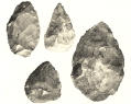
3.6 Prehistoric: Neolithic
3.6.1 The Neolithic saw the development of agriculture and the first
evidence for largescalecommunal activity. New ideas relating to the
domestication of animals and the cultivation of cereals were adopted,
together with new technologies such as pottery. Environmental evidence
indicates a major phase of woodland clearance
taking place, as land was opened up to provide fields and sacred spaces.
Essex is replete with Neolithic sites, both domestic and monumental.
Domestic sites are often represented archaeologically by concentrated
flint scatters with associated pits, and occasionally ditched enclosures,
whilst standing earthworks, such as
causewayed enclosures, earthen long and round barrows, cursus monuments,
henges and standing stones are indicative of the ritual environment.
The area between the Rivers Stour and Colne is no exception, with
a number of important sites, such as at Lawford . Many of these sites
are represented by cropmarks (see Section 5).
3.6.2 The Essex SMR records two finds of Neolithic date within the
Study Area. Both comprise isolated flint artefacts, an axe head and
a chisel .
3.7 Prehistoric: Bronze Age
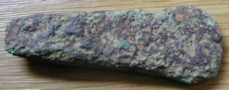
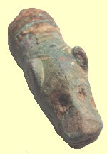
2000BC
Bronze Age flat axe
3.7.1 The Bronze Age is best characterised by the introduction of
metals, firstly gold and copper and later bronze, and first developed
as part of a cultural package labelled as Beaker.1The transition to
the Bronze Age in terms of the landscape is marked by a significant
increase in both visible settlement patterns, and in the
number of round barrows constructed, often with single inhumation
or cremation burials. These monuments heralded a new way of thinking
about society as they represented the burial of individuals in contrast
to the communal burials of the 1 It used to be thought that the Beaker
assemblages, which often included archery equipment, wereintroduced
by a group of invaders, the ‘Beaker folk’. This idea has
been replaced by one of indigenous native people adopting a new ‘lifestyle
package’, with no associated movement of populations preceding
Neolithic. This suggests the emergence of social elites, the division
of people into the rulers and the ruled. Although in many parts of
the country (e.g. the South Downs) the barrows remain as upstanding
earthworks, in the eastern counties they tend to have been ploughed
away, leaving only ring ditches and
cropmarks. By the Middle Bronze Age, c.1500 BC, nucleated cremation
cemeteries predominated within an increasingly structured world, and
agricultural demarcation of the landscape assumed greater visibility
in the landscape through the development of field systems.
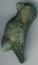
850BC
Bronze Age axe hoard
3.7.2 The Essex SMR records two Bronze Age sites within the Study
Area. Both are artefactual in nature. The most significant comprised
a cremation urn (a tripartite collared urn) of Early Bronze Age date,
in the field just southwest of the Site. The urn was found to contain
‘six pints’ of bones, identified as those of two individuals,
an adult and a child. The find undoubtedly forms part of a much wider
ritual landscape represented in the
extensive cropmark evidence that is known in the vicinity (see Section
5). The second SMR entry relates to a casual find of a Late Bronze
Age socketed axe head . No evidence was found of Beaker period activity
to substantiate a local tradition of a Beaker burial located in the
vicinity. It is probable that this is a confused reference to the
Bronze Age cremation discussed above.
3.8 Prehistoric: Iron Age
3.8.1 The Early and Middle Iron Age (up to c.100BC) saw the continuation
of trends developed in the Late Bronze Age. In the Late Iron Age most
of Essex and Suffolk were in the territory of the Trinovantes, whose
tribal capital was at Camulodunum (Colchester), an open site bounded
by long stretches of ditches and banks. It is known that the situation
was not static as, for example, the Trinovantes’ capital was
attacked and occupied by the Catuvellauni (from the west) under Tasciovanus
c.20 BC, although Trinovantian rule returned under Dubnovellaunus
(de Jersey 1996). The Trinovantes were subsequently absorbed into
the Catuvellaunian empire under Cunobelinus.
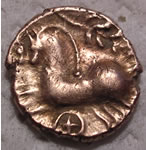
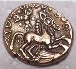
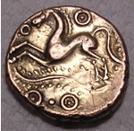
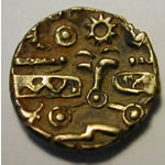
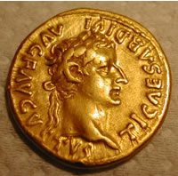
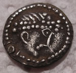
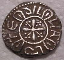
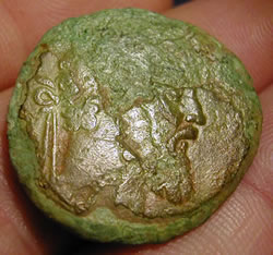
Celtic
gold coins from 45BC
3.8.2 Two main groups of evidence exist for Iron Age activity in the
vicinity of XXXX. One comprises the linear cropmarks of field systems,
ditched trackways and enclosures (see Section 5 for details). The
other consists of a considerable number of Iron Age coins, including
a significant and unusual proportion of gold
issues ( pers. comm. – see Website for details). The political
ebb-andflow outlined above (see 3.8.1) is reflected in the variety
of different tribal groupings represented in the coin finds, which
exist as both single finds and as
hoards, with an interesting concentration around XXXX. The prevalence
of gold coinage in this area must be associated with the proximity
of Camulodunum. It is also possible that peninsula was afforded some
special status. However, it would be unwise to speculate too far at
this point, given that many of the artefacts are literally ‘fresh’
out of the ground and have not had time to be thoroughly ‘digested’
by the relevant experts, and also by the fact that the outstanding
results from this area may be skewed by the unusually sustained and
systematic attention it has received over a number of years.
3.8.3 Ironically, given the number of coins and other artefacts found
over recent years, the Essex SMR records no Iron Age sites within
the Study Area itself.
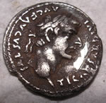
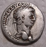
Roman
finds
3.9. Romano-British
3.9.1 Roman settlement in Essex comprised a network of small towns
surrounded by a dense scatter of smaller settlements, including villas
but mainly consisting of individual farmsteads. The exception to this
pattern comprised the native centre of Camulodunum, captured by Roman
troops (with the aid of an elephant) in
AD43 and established first as a fortress and subsequently as the provincial
capital. Destruction during the Boudican uprising saw a reduction
in status to provincial backwater. In landscape terms, there was much
continuity with earlier periods, although there was a gradual transformation
in building types, with circular round houses replaced by rectangular
structures of stone and timber construction. Villas were established
in the countryside, surrounded by extensive field systems, many of
which are still visible as cropmarks (see Section 5).
3.9.2 The Essex SMR records one Roman-British area. This comprises
a gold coin of Drusus Senior (brother of the Emperor Tiberius) found
on a farm in c.1890
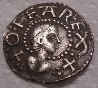
Offa
Rex Saxon coin
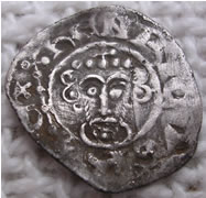
3.10 Anglo-Saxon
3.10.1
Essex was one of the first areas to be heavily settled by Germanic
peoples, who tended to prefer the more tractable soils of the coastal
plan and river valleys. A unified kingdom of the East Saxons emerged
by the late 6th century from a patchwork of smaller territories possibly
based on late Roman precursors (Rippon
1996). The kingdom lasted until the 9th century, when it was subsumed
into Wessex. Little is known of this Anglo-Saxon area , although the
name would suggest it originated as a daughter settlement of XXXXX
. The two parishes appear to form sub-divisions of a much larger original
estate. The name is of Saxon origin , but the earliest reference is
in the Domesday Book in 1087. The settlement pattern, which largely
developed from the Mid-Late Saxon period, differed from the classic
Midland pattern of nucleated villages clustered around church and
manor and surrounded by open fields. Essex conforms to the ‘Ancient
Countryside’ pattern (Rackham 1980; Roberts & Wrathmell 2000)
of dispersed settlement comprising small hamlets and isolated farmsteads
set within a mosaic of irregular enclosures and patches of open field
arable cultivation. Isolated churches are not indicative of former
nucleated settlement sites (Deserted Medieval Villages) but are rather
a central focus to which a scattered population would gather for significant
social events (attending church, festivals, markets etc).
3.10.2 The Essex SMR records reveal no Anglo-Saxon sites within the
Study Area, although a number of artefacts have been recovered during
metal-detecting sweeps.
3.11 Medieval
3.11.1 This area developed as part of a dispersed settlement, and
are listed together in Domesday (Reaney 1969). The parish appears
to have been divided among three manors both prior to the Conquest
and subsequently. The early historian Philip Morant identified the
area occupied by Queen Edith (wife of Edward the Confessor) in 1066,
which was subsequently granted to Walter the Deacon (Morant 1768)
and held by an unnamed knight. The record shows a mixed farming economy,
with plough teams indicating some arable cultivation and the presence
of cattle, horses and 100 sheep indicating extensive pasture. Woodland
is listed as suitable to support 40 pigs, although this is a unit
of measure rather than of stock (the record specifies 12 pigs later
in the entry), and the woodland itself may not necessarily have been
close by – many manors had out lying pannage rights (the right
to feed pigs in the manorial woodland) in areas of common waste beyond
the bounds of the manor itself. By the 12th century, the manor formed
part of the Barony of Hastings, held by the Hastings family of Little
Easton near Great Dunmow. The 14th century saw the manor in the hands
of the Godmanston family, two members of which (Walter in 13812 and
John in 1452) served as Sheriff of Essex and Hertfordshire.
3.11.2 The church of was the focal point of the parish, indicated
by its position at the hub of a network of roads, tracks and paths
that stretch out to every corner of the parish. It is not mentioned
in Domesday (which is not, however, proof that it did not exist),
but the earliest part of the existing structure is the early 12th
century nave .
3.11.3 The Essex SMR records three medieval sites within the Study
Area. , while the remaining two entries relate to artefacts found
within the churchyard
3.12 Post-medieval
3.12.1 The post-medieval period, prior to the 18th century, had seen
a gradual modification of the Medieval and earlier landscape, much
of which had become enclosed in piecemeal fashion. Up until the 18th
century, the general field patterns were
probably consistent with the irregular and sinuous enclosure of medieval
date, representing original assarting from the woodland, of which
only a small portion survives in the narrow sinuous plot across the
road. These early enclosures elsewhere were modified during the 18th
century to
produce large regular fields with straight boundary hedges of hawthorn.
Most of these later boundaries have been removed since 1950. The history
of the site during this period has been one of uneventful agriculture.
3.12.2 The Essex SMR records no post-medieval sites within the Study
Area.
3.13 Undated
3.13.1 The Essex SMR records eight undated sites. One entry is of
little significance, relating to an undated wooden pipe found in a
pond. The remaining seven entries are crop marks, which will be discussed
in greater detail in Section 5 comprises field boundaries and a ring
ditch, XXX comprises at least 25 ring ditches and a series of linear
features, XXX (including the Site) consists of mainly linear features
suggestive of field systems and trackways, but also includes numerous
ring ditches and several enclosures.XXX consist of field boundaries,
XXXX comprises ring ditches, pits and two trackways. Finally, XXX
is made up of pits and linear features. Dating crop marks is notoriously
difficult, and some may suggest the presence of prehistoric, or later
archaeological features
(see Section 5 for further discussion).
4.0
CARTOGRAPHIC EVIDENCE
4.1 The earliest map consulted of sufficient detail was Chapman and
Andre’s survey of Essex from 17773 (Fig. 2). This clearly shows
the site in a recognisable form, with the sinuous and maze-like medieval
road network. The existence at this time of unenclosed heathland commons,
utilised as common waste by the surrounding communities, is clear
from the map, with examples at Ardley Heath and Shuckmore Heath. The
land use of the site itself cannot be discerned, but is likely to
have been open farmland.
4.2 The Ordnance Surveyors’ draft plan of 1796-1800 (Fig. 3)
shows the area with more detail added. The field patterns shown bear
little resemblance to those of the 19th and 20th centuries, although
enough points of agreement can be discerned to indicate that the field
patterns shown were a fairly accurate record rather than a
stylistic convention. The pattern shown on the map suggests that they
represent the original medieval piecemeal enclosure landscape before
it was reorganised to form the regular geometric pattern visible on
later maps. The reorganisation must have taken place only a few years
after this map was surveyed.
3 An earlier map of the area dating to 1627 was listed in the Essex
Record Office in Chelmsford, but could
not be found
4.3
The Tithe Maps for the parishes (1844) (Fig. 4) show a different landscape
to that depicted in 1800. The original field patterns had been completely
swept away, to be replaced by large rectangular fields forming a regular
grid pattern with straight boundaries. This pattern is fairly piecemeal
in nature, as the maps indicate other blocks of fields in the vicinity
that have retained the original medieval patterns. This may perhaps
reflect a wealthier or more progressive landowner willing to spend
money reorganising his land to accommodate new farming techniques
while his neighbours were unwilling or unable to follow suit. Field
names on Tithe Maps
can often indicate sites of archaeological potential. In this case,
they are of little interest, although the name Cock Field may refer
to a former use for cockfighting. Osier Meadow indicates the streamside
cultivation of willow to provide withies for basket making, etc (Field
1993).
4.4 The 1st edition 6” Ordnance Survey map of 1875 (Fig. 5) shows
that more modifications had taken place during the previous thirty
years, with the site now covered by three huge fields with several
smaller plots along the southern and eastern margins. The 1897 and
1923 editions of the 25” map (not illustrated) show
an identical picture, and the current field pattern is very similar
apart from the removal of several of the smaller field boundaries
around the edge.
Roman
finds
5.0 AERIAL PHOTOGRAPHS
5.1 A search was made of the vertical and oblique collections of the
National Library of Air Photographs held at the National Monuments
Record Centre, Swindon. A total of 15 vertical prints and 67 specialist
oblique laser prints were consulted spanning the period 1946-1996.
Only five of the examined photographs had no cropmarks visible (marked
with an * in the tables). Crop mark plots were also obtained from
Essex County Council SMR office (see Figs 6 & 7). The following
aerial photographs were checked.
Table 1: Vertical Aerial Photographs
Sortie No. Frames Date Scale XXX
5.5
The ring-ditches are the earliest type of cropmark to be identified,
generally of Early-Middle Bronze Age date, although some may extend
back into the late Neolithic. A number of particularly large circular
cropmarks, up to 30m in diameter and comprising wide encircling ditches,
have until very recently been interpreted as henges (circular ritual
sites of Late Neolithic date), of which one example, described as
a Class 2 henge (i.e. having two opposing gaps or ‘entrances’
in the encircling ditch), is visible within the western part of the
site (Feature L on Fig. 6) (Erith 1968; Hedges 1980; Holgate 1996;
Kemble 2001). However, recent excavations on similar sites within
the county have consistently reinterpreted them as either Late Bronze
Age enclosures or Medieval and later windmills (Brown & Germany
2002).
5.6 Linear cropmarks forming enclosures Extensive areas of cropmarks
forming rectilinear enclosures are a major feature in the landscape
(as revealed by air photographs), often consisting of complex systems
suggesting superimposed multi-period landscapes. Some are likely to
be of prehistoric origin – at many sites, the rectilinear enclosure
boundaries respect the positions of ring-ditches, suggesting that
the barrow cemeteries were still
visible in the landscape as upstanding earthworks. Some may even be
contemporary with the cemeteries, representing a ritual focus set
within field systems – such an arrangement is represented at
Ardleigh.
5.7 However, many of the enclosures may well be of later date, primarily
Iron Age and Romano-British, and lie within a much larger system of
cropmarks aligned on common NW-SE and SW-NE axes which pre-empt a
similar alignment in the medieval and later field boundaries and road
network. The lack of any significant correlation between the cropmarks
and the medieval field boundaries (as indicated on the 1800 map) suggests
that medieval enclosures may have been laid out afresh following a
period of abandonment (perhaps associated with
woodland regeneration, as hinted in Domesday), but within a landscape
whose basic ‘grain’ was still evident (probably in the form
of trackways now followed by modern roads and footpaths).
5.8 Other linear cropmarks
These are difficult to interpret and date, representing both isolated
linear boundary features identifying the edges of discrete areas,
whether individual fields or larger territorial units such as estates,
and also constituent parts of
enclosures/field systems, of which the other elements have been destroyed
(or are not visible as cropmarks). They range in date from the Neolithic
up to the 20th century.
5.9 Sinuous cropmarks
These cropmarks are clearly differentiated from the examples discussed
above by their sinuous nature. They wind through the landscape with
little or no clear relationship with the other types of cropmark,
and are often wider with more diffuse edges. These are probably of
natural origin, representing geological features or the course of
former waterways (palaeo-channels). It is known from environmental
studies that the flat plateau that now characterises the north Essex
landscape was formerly dissected by many more small stream valleys
than are
now evident in the modern landscape. These valleys have subsequently
silted up.
5.10 Small discrete cropmarks
These cropmarks are also difficult to characterise and date. Some
may represent geological features of natural origin, while others
may be archaeological in nature, perhaps representing clusters of
pit graves.
5.11 The andscape
The Site is covered by a dense and complex network of cropmarks, including
examples of all the types discussed above. The complex nature of the
cropmarks indicates quite clearly that a multi-period landscape is
represented here, with many cropmarks crossing others with little
regard to alignment.
5.12 The barrow cemeteries
The earliest features are likely to be the ring-ditches. Three groups
are evident (Fig. 6 - A, B and C). A comprises one large ring-ditch
with at least four smaller examples scattered around it, one of which
clearly contains a central burial pit (Plate 2). The two northernmost
ring-ditches, and possibly the larger one, are cut by later linear
cropmarks suggesting that they had ceased to be visible when these
later field systems were laid out.
5.13 Group B also comprises one large ring-ditch flanked to the north
by at least ten smaller examples (Plate 1). Several pits are visible
within some of these ringditches. This group appears to be respected
by a rectilinear enclosure boundary, which encloses it on the north-east
and north-west sides before heading off to the
north-west. This may indicate that the enclosure was contemporary
with the cemetery (although if so, why not enclose the southern part
as well, or was this side limited by a stream channel now represented
by a wide sinuous cropmark?), or was laid out at a time when the cemetery
was no longer in use but still visible as a landscape feature (and
perhaps retaining some spiritual resonance as sacred ground).
5.14 Group C contains one possible ring-ditch, which is cut by (or
possibly cuts) the western arm of a rectilinear enclosure. The three
separate groups of ring-ditches indicate that some compartmentalisation
of the landscape was taking place. This is further suggested by reference
to Plate 2, where each group occupies a distinct
block of land bounded by sinuous cropmarks and largely amorphous areas
suggestive of geological features. These may well relate to former
stream channels.
5.15 Enclosures
The most striking cropmarks concern an extensive series of rectilinear
enclosures. At least two separate phases are visible from the photographs
(Plates 1-4) (although many more phases may actually exist, as not
all the features that respect, or appear to respect, each other are
necessarily contemporary), with a complex arrangement of regular rectilinear
enclosures of various sizes crossed by, or crossing over, a less regular
pattern of slightly curvilinear cropmarks. The regular
enclosures are best interpreted as field systems, probably evolving
over time with not all the visible elements of contemporary date.
Several smaller square features (Fig. 6 – D & E) are visible
within the overall pattern, possibly relating to small paddocks or
possibly even settlement foci (although there is no obvious sign of
internal features). Five lengths of trackway are visible, delineated
by parallel ditches (Fig. 6 - F-J). These represent droveways allowing
access to and between the various fields and other enclosures, and
were probably originally bounded by stock-proof hedges similar to
those that survive in the present landscape.
5.16 A curvilinear enclosure (Fig. 6 - K), now straddled by the parish
boundary, is noticeably different from the largely geometric pattern
within which it sits. Nevertheless, it seems to be part of the field
system, as it lies within the easterncorner of one large square field.
A large number of prominent discrete features are visible within it
(Plate 2), which may suggest the presence of pits. This feature may
be a possible settlement enclosure, with the pits representing storage
pits for grain, a common Iron Age practice.
5.17 Other features
The western side of the site is occupied by a large circular cropmark
(Fig. 6 - L). This feature superficially resembles a henge in shape,
and has often been interpreted as such. However, recent excavations
on similar sites have revealed that many of them are actually windmill
mounds. A similar interpretation is suggested for this example. This
suggestion is supported by photographic evidence. Plate 1 shows the
feature clearly positioned astride several linear cropmarks relating
to a rectilinear enclosure. The linears are not visible where they
would cross the feature, indicating that it is later in date (a henge
would normally be dateable to the Late Neolithic/Early Bronze Age,
while the rectilinear enclosures are probably of later prehistoric
date). In addition, the
feature is formed of a whitish ring of material, suggestive of a mound
that has been ploughed flat and the material spread about. The fact
that the mound material retains a distinctive colour suggests that
it is not of any great antiquity, as colour differentials would be
expected to disappear over time.
5.18 Finally, two areas of amorphous dark blotches (Fig. 6 - M and
N) visible on Plates 1-3 highlight areas of gravel quarrying, probably
of 18th-19th century date (Erith 1968).
6.0
WALKOVER SURVEY
6.1 A rapid walkover survey by the author was undertaken in respect
of the site on 11th October 2005. Conditions were good, being generally
dry, bright, and sunny.
6.2 The objective of the walkover survey was to identify historic
landscape features not plotted on existing maps, together with other
archaeological surface anomalies or artefact scatters, in order that
they may be described and added to the existing archaeological dataset
for the appraisal site.
Continued
on page 2